Why Rivers Make Some Regional Boundaries Feel Natural
Why rivers make some regional boundaries feel natural depends on the banks, crossings and stretches people use. Learn how to read a river’s role in regional identity.
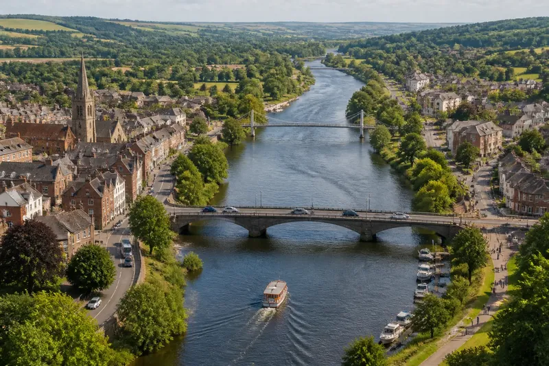
Why rivers make some regional boundaries feel natural becomes clearer when you stand at a bridge and look both ways. One bank may feel like home, the far bank like somewhere else, while the water between them carries boats, visitors and everyday traffic. To understand a river’s part in regional identity, follow the banks, crossings and changing stretches rather than treating the blue line on a map as a complete answer.
Where does the river first seem to divide the region?
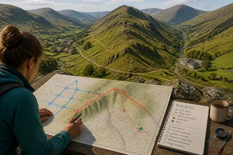
Begin with a map at a useful local scale, such as an Ordnance Survey sheet or a regional road map. Trace the river through the area you want to understand, and note where roads, railways and named places approach it. This first pass identifies possible boundaries; it does not yet tell you whether residents experience them as such.
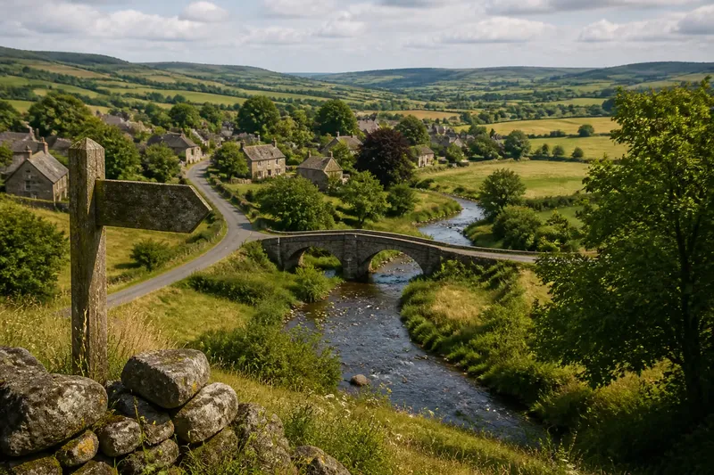
Then choose a specific stretch, not the river as a whole. A broad estuary, a narrow urban channel and a small stream in a wooded valley can have very different effects, even if a map gives each a similar line. Record visible changes along the stretch: bridges becoming scarce, banks rising, the channel widening, or roads clustering at a crossing.
These features matter because a boundary is not simply a physical obstacle. It is a repeated distinction people notice and use. Water can make that distinction easy to see, but a bridge or ferry can also make the opposite bank part of an ordinary journey.
Which bank belongs to which local story?
Look for the names and institutions attached to each side. A river may separate council areas, school catchments, parishes or historic districts, but those boundaries do not necessarily coincide. Compare a local authority map with street signs, bus routes and the names used by nearby organisations.
Pay attention to how people describe direction. “Across the river” can suggest a meaningful change of place, while a neighbourhood name may stretch over both banks. The distinction is worth checking in context: a phrase used for a sports rivalry may carry a different weight from one used in a postal address or a council document.
Imagine you are tracing a fictional town where the old centre lies on the east bank and a newer residential district sits opposite. The town council serves both, but the secondary school and regular bus routes are organised separately on each side. You might expect the river to mark an administrative edge while shared council services and the bridge keep the town connected; comparing the maps and route notices would show which distinction residents encounter in ordinary life.
How does crossing the river change what it means?
List the ways across the water and consider who can use them. A road bridge may carry commuters and deliveries; a footbridge may mainly connect nearby streets; a ferry may join places that face each other but lack a direct road. A crossing creates a practical link, yet its location can also make one route feel central and another remote.
Use a local transport map, then check it against the street layout. A bridge that looks close on paper may lead to a circuitous approach, while a ferry may operate only on certain days or serve a limited set of journeys. Do not assume that the nearest crossing is the one people rely on.
Compare the approaches as well as the crossing itself. If roads on both banks feed into the same bridge, it may function as a shared gateway. If one side has a direct route and the other requires a long detour, the river may feel more like an edge to people making everyday trips from the less connected bank.
What does each stretch invite people to do?
Follow the river beyond its most familiar bridge. Some stretches are lined with paths, quays, parks or moorings that draw people towards the water. Others have steep banks, industrial land or few public access points, making the channel more of a back edge than a shared public space.
Read a walking map alongside land-use information, and note where access changes. A continuous riverside path can link several neighbourhoods without making the river cease to divide them. Conversely, a busy crossing may connect two sides while the surrounding banks remain inaccessible.
This is why a river can act as a corridor and a boundary at once. Think of a fence with a gate: the fence marks a separation, but the gate gives people a regular passage through it. The river itself is less like a fixed fence, though, because its width, banks and available crossings can change from one stretch to the next.
Which clues reveal a boundary that is felt as well as mapped?
Compare several kinds of evidence rather than relying on a single sign. Maps show formal lines and physical features; transport information shows available connections; local names and institutions hint at shared identities. Each describes a different part of the relationship between the water and the region.
- Administrative maps: Check whether a council, parish or district line follows the channel or crosses it.
- Street and service maps: See whether roads, buses and pedestrian routes connect both banks or favour particular crossings.
- Local place names: Note whether named neighbourhoods sit on one bank, span the river or refer to the whole settlement.
- Public access maps: Look for riverside paths, parks, quays and places where the bank is closed off.
- Local notices and directories: Compare the areas served by schools, community groups and public facilities.
These clues should be read together. A jurisdictional line following the water is evidence of formal division, not proof that residents feel separated. A path joining both banks indicates access, not necessarily a shared identity.
What questions help you read a river boundary?
Does a river always separate two regions?
No. It may divide administrative areas or local identities in one place and serve as a shared route or meeting point in another. Its effect depends on the stretch, the crossings and the ways people refer to the banks.
Why can a bridge make a boundary feel stronger?
A bridge concentrates movement at a particular point, making the crossing itself a familiar marker between sides. If roads, services or local names differ across it, the transition may become especially noticeable.
Can both banks belong to the same regional identity?
Yes. Shared institutions, routes and place names can connect communities on opposite banks, even where an administrative boundary follows the water. A river’s visibility does not decide which identity people use.
Why does the same river feel different further downstream?
The channel, land use and access may change, as can the number and type of crossings. A stretch with a public waterfront can feel like a shared corridor, while a less accessible section may be experienced mainly as an edge.
How can you describe what the river is doing?
Once you have compared the banks, crossings and stretches, describe the river in terms of a particular place and relationship. For example, say that one stretch marks a council boundary, while a nearby bridge links two neighbourhoods and a riverside path connects their public spaces. This is more precise than calling the whole river a natural border.
Keep physical, administrative and cultural boundaries distinct. The channel is a landform; a council line is a legal division; a local sense of “our side” is a social distinction. They may overlap, but they need not. Where the right interpretation depends on an official boundary, consult the relevant local authority map; for access or transport details, use the service’s current information.
Why rivers make some regional boundaries feel natural is ultimately a question of viewpoint and routine. Start with the stretch people can see, then follow the crossings and the names that connect or distinguish its banks. That gives you a grounded description of the river’s role without mistaking a visible line for a complete account of the place.