Grid or Ridge Route Planning Across Hilly Ground
Grid or ridge route planning helps compare links, junctions and terrain so you can choose a route that serves useful destinations without awkward crossings.
Which route across hilly ground will serve people best? Grid or ridge route planning compares a regular network of crossings with a main line that follows higher ground. The choice depends not only on slopes, but on where journeys begin and end, which junctions matter and how the route connects to local paths.
A route is part of a network, not just a line between two points. A grid can offer several ways between places, while a ridge route can provide a continuous spine with branches down to settlements. Comparing those functions helps distinguish a route that looks orderly from one that makes everyday connections possible.
What does a grid offer as a network?
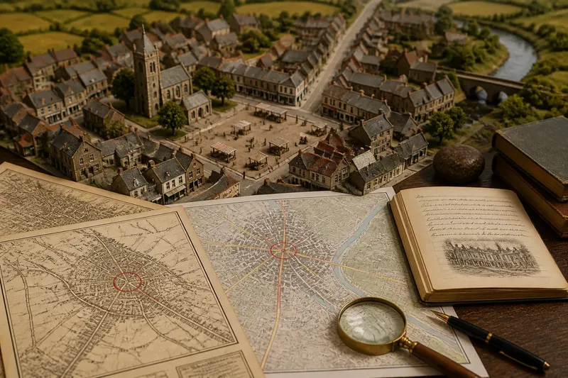
A grid arranges routes in a repeated pattern, with parallel lines joined by crossings. Its main advantage is choice: if one connection is inconvenient, another may lead towards the same destination. Regular junctions can also make a network easier to describe and extend.
That pattern can become less useful where the land interrupts it. A grid line might end at a steep face, leave a stream without a workable crossing, or pass between settlements without connecting to them. A neat arrangement on a map does not by itself show whether the junctions function as links.
Think of a grid as a set of shelves: the repeated structure is easy to follow, but the contents still need to be placed where people can reach them. For route planning, that means checking whether each crossing joins useful paths and destinations rather than simply preserving regular spacing.
What role can a ridge route play?
A ridge route can serve as a main line through broken country, with side connections reaching places on lower ground. It may avoid some of the repeated crossings between valleys that a regular grid would require. The route need not cling to the highest crest; a gentler shoulder or a pass around a rocky spur may make a more useful alignment.
The shape of a ridge can limit its value as a network. It may curve away from a destination, divide into branches or pass above a settlement without an easy way down. A ridge line is most useful when its junctions with local paths are reachable and lead somewhere people need to go.
Higher ground can also be exposed, while lower routes may meet streams, marshy ground or steep valley sides. These conditions affect how routes connect and what maintenance or access considerations may arise. The proposed route’s purpose and users should guide which trade-offs deserve attention.
How do route purpose and junctions change the choice?
Before comparing alignments, state what the route is meant to do. A link between two settlements has a different job from a route intended to connect several farms, a station and a school. The most useful option is the one whose junctions support those journeys, not necessarily the one with the simplest outline.
Mark the destinations and the connections people may need between them. Then ask whether a grid offers alternative links, whether a ridge route needs branches, and whether either option leaves a community on the far side of a difficult crossing. A junction is valuable when it connects routes that serve real destinations; a crossing with no useful onward link may add little.
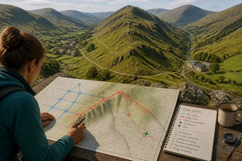
Say you are planning a fictional route between two upland villages, with a clinic on the eastern side of a ridge. The starting choices are a regular grid line that crosses the ridge twice and a ridge-shoulder route with branches towards each village and the clinic. If the stated priority is reaching the clinic, the branch option better matches that purpose; if the main need is a direct village-to-village connection, the repeated crossings may deserve closer consideration. The choice turns on the intended journeys, not on an invented claim that one route is universally easier.
How can you compare route options on a map?
Begin with a topographic map that shows contours, streams, settlements and existing routes. Contours represent height; lines close together indicate steeper ground, while wider spacing indicates a gentler slope. A saddle is a lower point between higher parts of a ridge and may provide a connection across it.
Trace each candidate route and mark where it meets existing paths, roads or destinations. Compare the whole network: a line can be direct between two endpoints yet leave useful places unconnected, while a longer line may link several branches. Check more than one map scale, since a regional view helps show the broader network and a detailed view may reveal local barriers or junctions.
- Destination connections: Check whether each option reaches the named settlements and services. If a route misses a priority destination, then add a branch or compare an alignment that reaches it; otherwise, retain it for the next check.
- Junction usefulness: Check whether a junction connects to an onward route or ends at an isolated point. If it is isolated, then shift it to meet a useful path or remove it from the proposed network; otherwise, keep the connection.
- Contour crossings: Check where a route crosses closely spaced contour lines. If several steep crossings occur, then compare a ridge shoulder, saddle or alternative alignment; otherwise, keep the route for consideration.
- Stream and valley links: Check whether the route meets streams or steep valley sides at workable crossing points. If a crossing appears awkward or unconnected, then seek another crossing or mark the route for local assessment; otherwise, retain the candidate pending a condition check.
- Network alternatives: Check whether the grid provides another way around a blocked or inconvenient section. If it does not, then consider adding a cross-link or a separate route; if it does, then keep the alternative connection in the comparison.
- Ridge branches: Check whether a ridge line has practical links down to the places it is meant to serve. If those links are missing, then consider a branch or a different main line; otherwise, compare the ridge option with the grid on its overall connections.
These map checks help identify questions; they do not establish the condition of a path or the suitability of construction. Verify current access and local conditions through appropriate sources. Where a route has construction or public-safety implications, seek relevant professional advice and permissions.
When is a grid, ridge or combined layout more suitable?
A grid can suit places where routes need to offer multiple connections and the land allows those crossings. It may be particularly useful when a settlement already has a regular network that new links can join. On difficult ground, local bends or missing cross-links may be needed to make the pattern function.
A ridge route can suit a longer connection through broken terrain where lower routes would involve repeated valley crossings. It works best as a network spine rather than as an isolated crest line, with branches that reach relevant places. If those branches are steep, inaccessible or absent, the ridge may be less useful than its continuity suggests.
A combined layout can use a ridge route for the main connection and grid-like paths for local movement. This distributes different jobs across the network: the ridge line carries the broader link, while local routes connect homes and services. The arrangement still needs useful junctions between the two parts.
Which route-planning questions should you settle first?
Does the shortest line make the best route?
Not necessarily. A short line may cross steep ground or miss important destinations, while a longer one may connect more of the network. Compare its purpose, junctions and terrain rather than distance alone.
Can a ridge route serve a settlement below it?
Yes, if a suitable branch or crossing connects the ridge to the settlement. Check the route between them rather than assuming that passing above a place provides useful access.
Why add cross-links to a grid?
Cross-links can connect destinations that a set of parallel routes would otherwise leave apart. If the links meet useful routes and avoid difficult ground, they can make the network more flexible; if not, they may add complexity without improving access.
What should you do when a map leaves a crossing unclear?
Check a more detailed map and seek current local information about access and ground conditions. If the route has significant construction or safety implications, ask an appropriate professional to assess the site before decisions are made.
How do you choose a workable alignment?
Write down the route’s main purpose, the destinations it must connect and the junctions needed to make those links useful. Compare the grid, ridge and combined options against those requirements, noting where each creates a missing link or difficult crossing. Keep separate the facts visible on the map and the conditions that still need checking.
For grid or ridge route planning, a useful decision comes from matching network shape to the journeys it must support. A regular grid may offer alternatives; a ridge line may provide a main connection. In either case, check that the links between the route and its destinations are practical before treating the alignment as settled.