Reading a Valley from Its Opposite Slopes
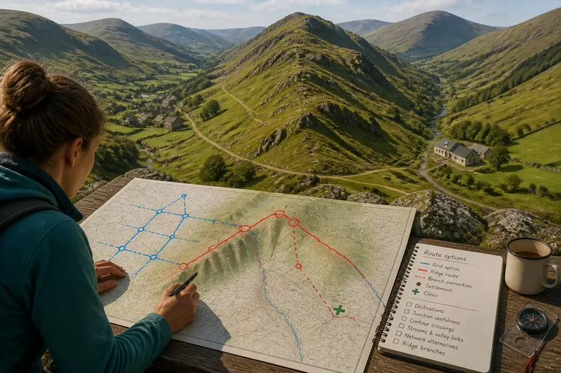
Reading a valley from its opposite slopes helps you compare the valley floor, skylines and side hollows to form a careful picture of its cross-section.
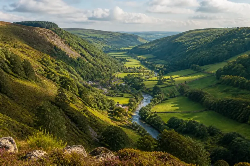
Reading a valley from its opposite slopes begins with a practical question: how does the hollow connect the floor, its side slopes and the skylines beyond? From a viewpoint with a broad view, those relationships can form a mental cross-section without requiring you to identify every feature.
Look for where the valley’s sides meet the floor, where side hollows enter, and how much of each slope is hidden. These observations describe the shape you can see; they do not, on their own, explain how the valley formed.
Where can you see the valley as a whole?
Choose a public viewpoint such as a bridge, an established footpath bend or an open area above the valley floor. A useful position lets you see at least part of the floor and both opposing slopes. If trees or buildings block a section, note the obstruction rather than treating the hidden ground as smooth.
First identify the floor: it may be a strip beside a stream, a wider area with fields or buildings, or a narrow corridor with little level ground. Notice whether projecting spurs make it appear to narrow, and whether a side hollow interrupts one slope. These features give the cross-section its basic arrangement.
How do the slopes meet the floor?
Follow each side visually from its skyline down towards the valley floor. The lower part may fade gradually into level ground, end at a steep bank, or be concealed by trees and buildings. Compare the two junctions: one side may reach the floor abruptly while the other blends into a wider strip of ground.
Look for shelves, exposed rock faces and changes in vegetation, but treat them as visible clues rather than exact boundaries between landforms. A line of trees might follow a break in the ground, or it might reflect planting or land use. The landform is clearer when the shape of the ground supports what the surface pattern suggests.
Then note the shape of each skyline and the valley floor between them. The floor may sit between two steep sides, or one side may rise more gently than the other. Distance and viewing angle can make the far slope look flatter, so describe the contrast you see without assuming it represents the slopes’ true proportions.
What can side hollows tell you?
A notch in a skyline may mark a side valley, while a narrow groove running down a slope may indicate a gully. Look for continuity between the hollow and the main valley: does it appear to lead towards the floor, or is it only a dip in the visible outline? If woodland hides its lower section, leave that connection uncertain.
Watercourses, field edges and tracks can help you follow a hollow’s direction, but they are not landforms in themselves. A road may cross a slope for practical reasons, and a boundary may follow a property line rather than a change in gradient. Check whether the ground’s visible shape agrees with the line’s direction.
How can changing viewpoints clarify a valley?
From the valley floor, one slope may fill much of your view while the opposite side appears compressed. From high on one side, the nearby lower slope may disappear beneath you. A second viewpoint can reveal what the first one concealed, much like turning a mug to see its far side rather than guessing at its shape.
Imagine you are on a public path beside a stream, and a wooded spur hides the far side. You continue along the established path to an open bend, where the floor and both skylines become visible. You can now judge whether the valley seems to continue behind the spur or open into a broader section, while leaving the ground beneath the trees undescribed.
As you move between viewpoints, note which features appear or disappear. A spur may hide the floor but leave the skyline visible; a bend may expose a side hollow that was previously concealed. Record the position of each view so that you do not mistake a change in visibility for a change in the valley itself.
Which questions help when a valley view is incomplete?
How can I distinguish a side valley from a dip?
A side valley usually appears as a hollow that continues into the main slope, sometimes with a notch in the skyline or a visible drainage line. A dip may interrupt the outline without showing a connected hollow. If cover obscures the ground, describe the visible notch and leave its origin open.
Why do the opposite slopes appear unequal?
Distance, viewing angle and vegetation can change how steep or detailed a slope looks. Compare where each side meets the floor and the shape of its skyline, but do not treat apparent differences from one viewpoint as a complete account of the land.
Can a stream or track help me understand the valley?
It can show where water or movement follows a hollow, but neither line necessarily marks the valley’s full shape. Check whether the visible ground rises or falls alongside it, and distinguish the route or channel from the landform around it.
What should I record when part of a slope is hidden?
Note your viewpoint, the visible skyline, the apparent width of the floor and what blocks the view. Mark any inferred connection as uncertain rather than drawing in ground you cannot see.
How can you keep a useful record?
Make a quick sketch with the floor as a band, the opposing skylines as simple lines, and only the most distinctive features: perhaps a notch, a broad lower slope or an abrupt junction. Add which side of the valley you were viewing from. The sketch is a reminder of relationships, not a precise profile.
- If both skylines are visible, mark each separately; if one is blocked, leave that outline open rather than completing it by guesswork.
- If the floor looks continuous, draw it as an unbroken band; if a spur appears to pinch it, mark the narrowing and check from another viewpoint.
- If a hollow seems connected to the main valley, draw the visible section; if cover hides its lower end, use a question mark at the concealed connection.
- If a shelf or rock face is visible, mark its position on the slope; if only a tree or field boundary suggests a break, record the surface clue without labelling it as a landform.
- If a track or stream follows a hollow, note its direction; if the surrounding ground does not confirm the shape, keep the route or channel separate from your landform description.
- If two viewpoints show different details, record where each view was taken; if the difference may come from distance or obstruction, avoid describing it as a change in slope shape.
For example, imagine you stand on a public bridge with a stream below, a broad grassy strip on one side and a wooded slope on the other. You sketch the visible floor and both skylines, mark a notch in the wooded outline, then walk along the established path to a bend where the notch’s lower hollow comes into view. Your revised sketch links the notch to a side hollow, while the obscured ground above it remains uncertain; the useful result is a clearer cross-section, not a claim about how the valley formed.
Reading a valley from its opposite slopes is most useful when the record distinguishes visible shape from inference. Keep the floor, the meeting points of the slopes and any side hollows in view, and leave concealed sections blank until another safe viewpoint reveals them.